
Harnessing the power of social media for emergency response and disaster management.
Tata Center project Risk Map is now live in Chennai, India. MIT Researchers from the Urban Risk Lab—including Tata faculty Associate Professor Miho Mazereeuw, research scientist Aditya Barve, and Tata Fellow Abraham Quintero—have been developing a free platform that allows communities to report disaster-related, time-critical information through social media.
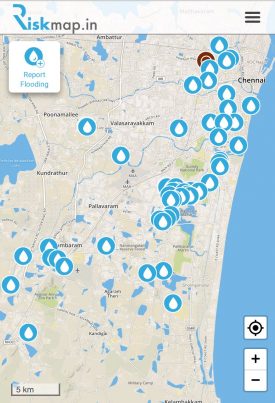 Users can conveniently report flooding with Twitter, Telegram, and even Facebook messenger. The Risk Map framework then uses this information to create and present real-time data immediately to users and first responders.
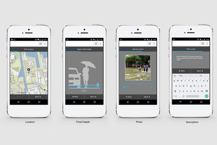
The platform enables users to report details such as flood location and water depth, as well as add photos of flood sites with a description. Once a report is submitted, users have the option to share a link to their report with friends and family. All reports are gathered onto a real-time flood map and Risk Map also works with local government agencies so that flood alerts and updates can be added to the map.
This platform aims to improve disaster preparedness and response in communities throughout megacities in South and Southeast Asia. By gathering, sorting, and presenting data of flooding reports the Urban Risk Map team is working to channel the noise of social and digital media into meaningful and powerful social impact.